Sunday, October 28, 2007

Sweden-Danmark-Germany / Schweden-Dänemark-Deutschland

Es war schon Ende September als ich mich nach Stockholm aufmachte um meine Tour fortzusetzen.
Dort angekommen erinnerte mich nichts mehr an die Tage im Sommer. Abends, schlug ich einfach mein Zelt auf dem Clubgelände auf und hoffte, dass am nächsten Morgen schon irgendjemand auftauchen würde um mich an mein Boot zu lassen.
Nur drei Tage blieb ich hier, die Nächte waren schon ziemlich kalt und tagsüber war es oft neblig oder bewölkt. Doch ich wollte diese Erfahrung im Herbst machen und habe es nicht bereut.
Einen Monat lang war ich an der Ostküste Schwedens und Dänemarks unterwegs bis ich letztendlich  Fehmarn erreichte.
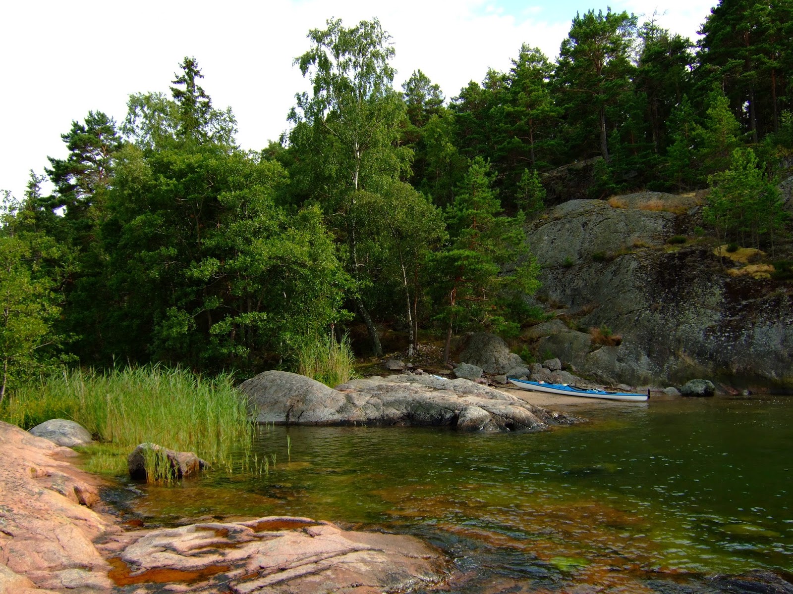
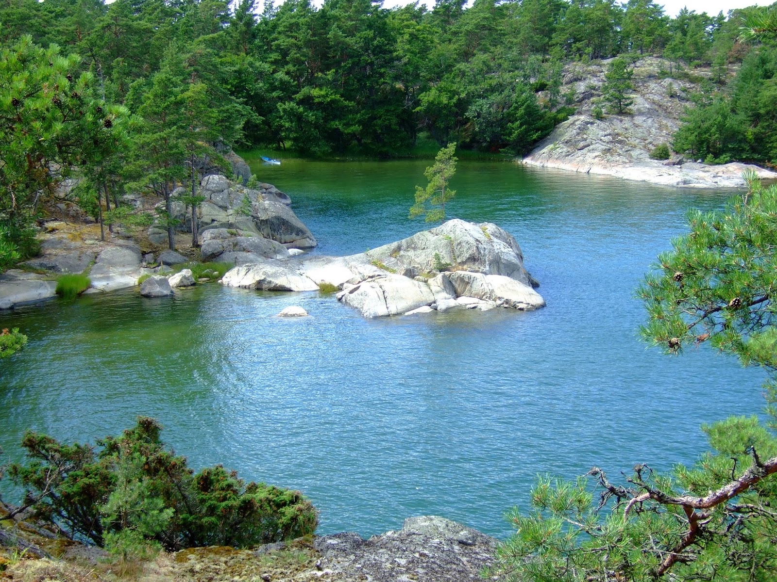
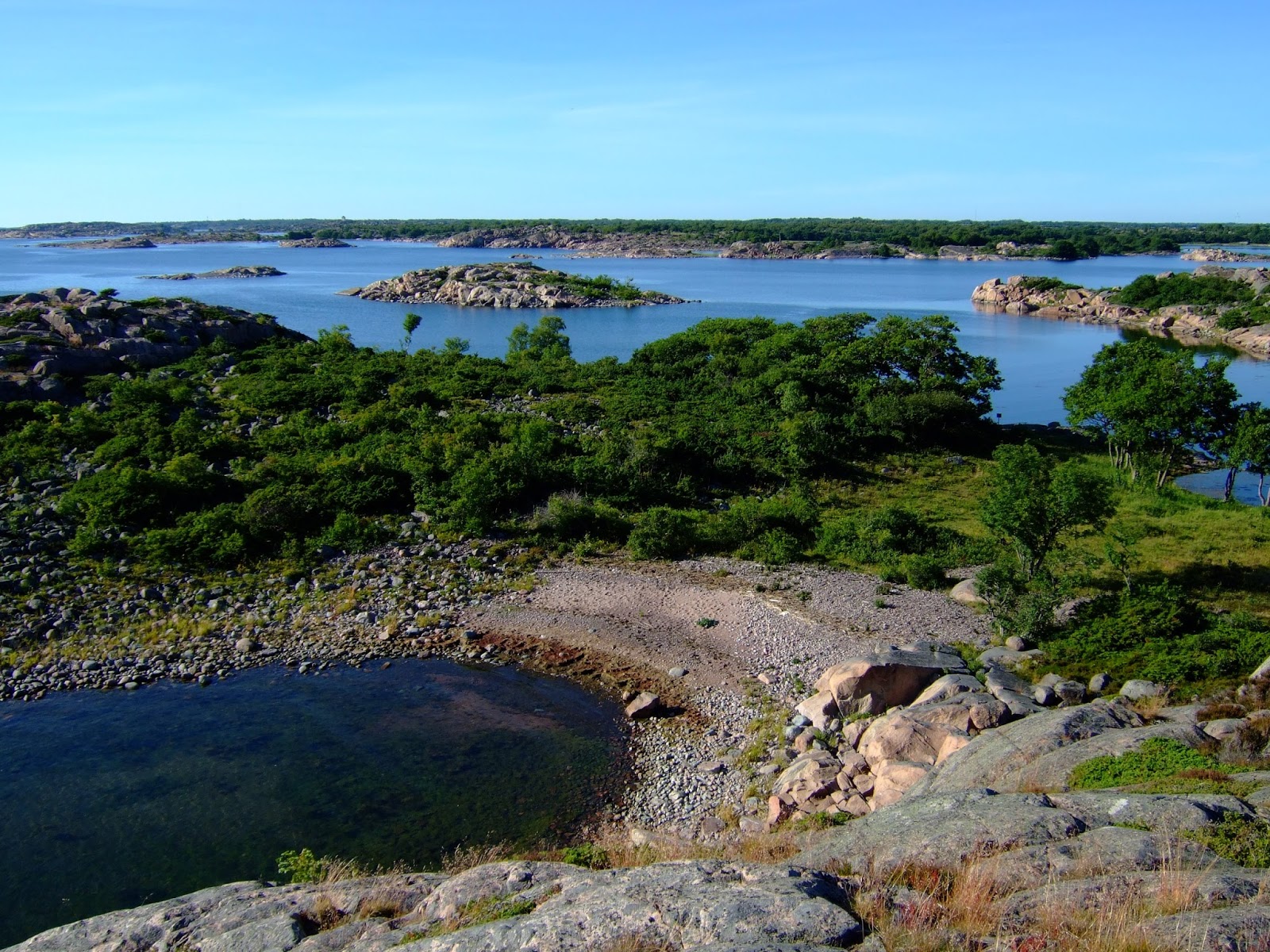
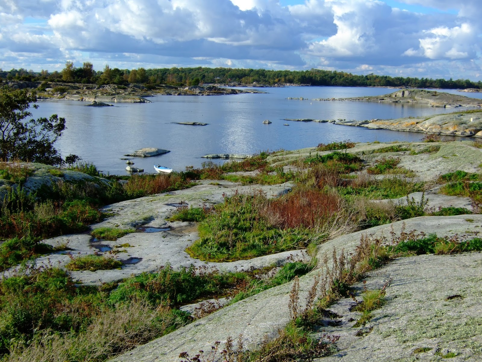
Meine Route führte mich zuerst aus der Stockholmer Schärenwelt Richtung Süden heraus. Noch eine ganze Weile ging es zwischen hunderte von Insel südwärts, bis die immer weniger wurden. Irgendwann habe ich sie dann ganz vermisst und dachte noch an so manchen Tagen daran wie schön es dort war. Ob ich jemals wieder hierher kommen werde?
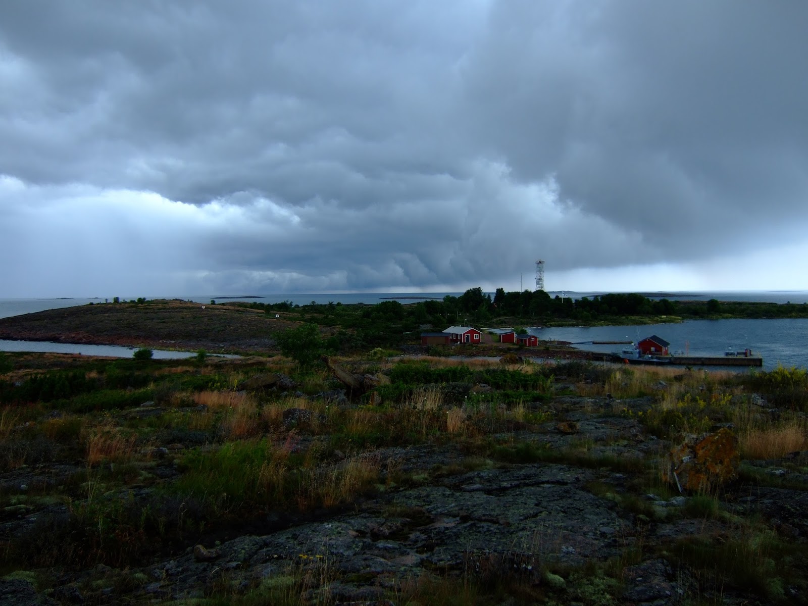
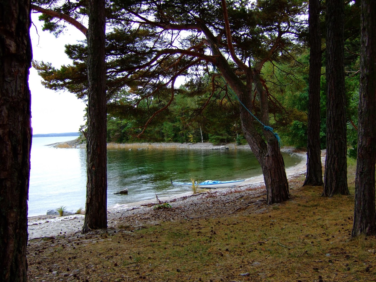
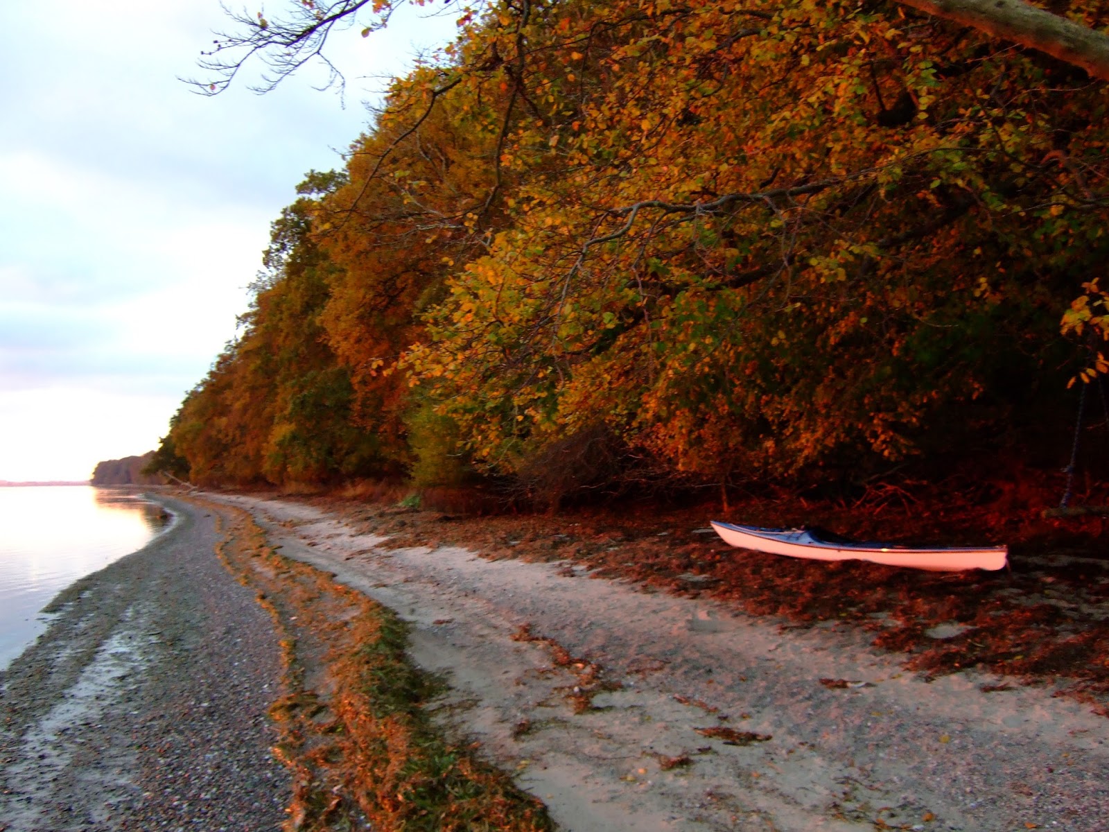
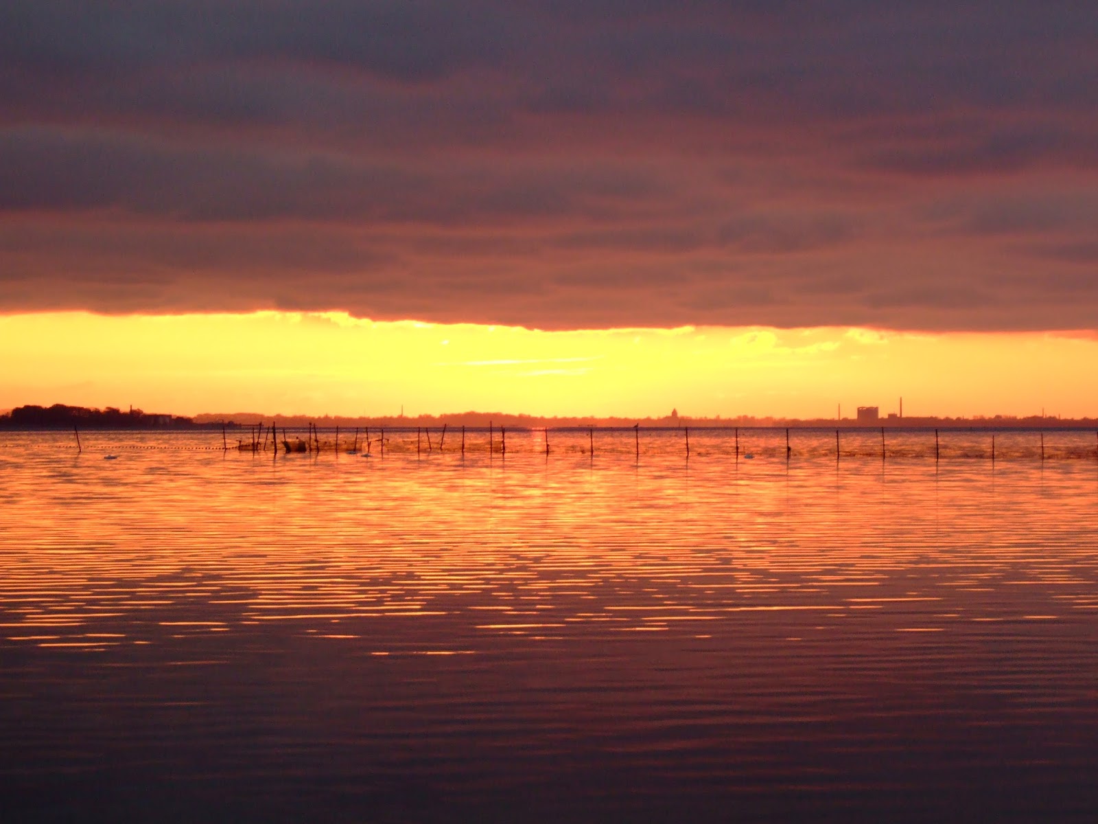
Die Landschaft empfand ich als atemberaubend schön. Die Abendsonne und aufkommender Nebel tauchen die Inseln in ein mystisches Licht das es so nur in dieser Jahreszeit gibt. Es war meine intensivste und schönste Zeit auf meiner ganzen Reise soweit. Auch die Stille und Einsamkeit haben mich sehr berührt. Doch auch die unangenehmen Seiten des Herbstes habe ich zu spüren bekommen. An einigen Tagen regnete es und starker Wind und Seegang machten mir allzuoft  das Leben schwer. Auch die frühe Dunkelheit war an manchen Tagen ein Problem. Manchmal zögerte ich den Landgang so sehr hinaus, in der Hoffnung doch noch einen schönen Lagerplatz zu finden und musste dann doch im Dunkeln an Land gehen.
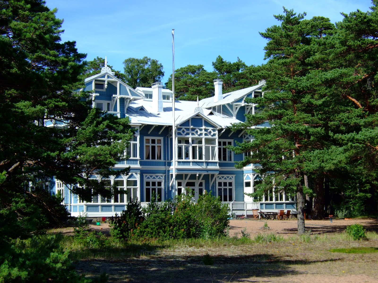
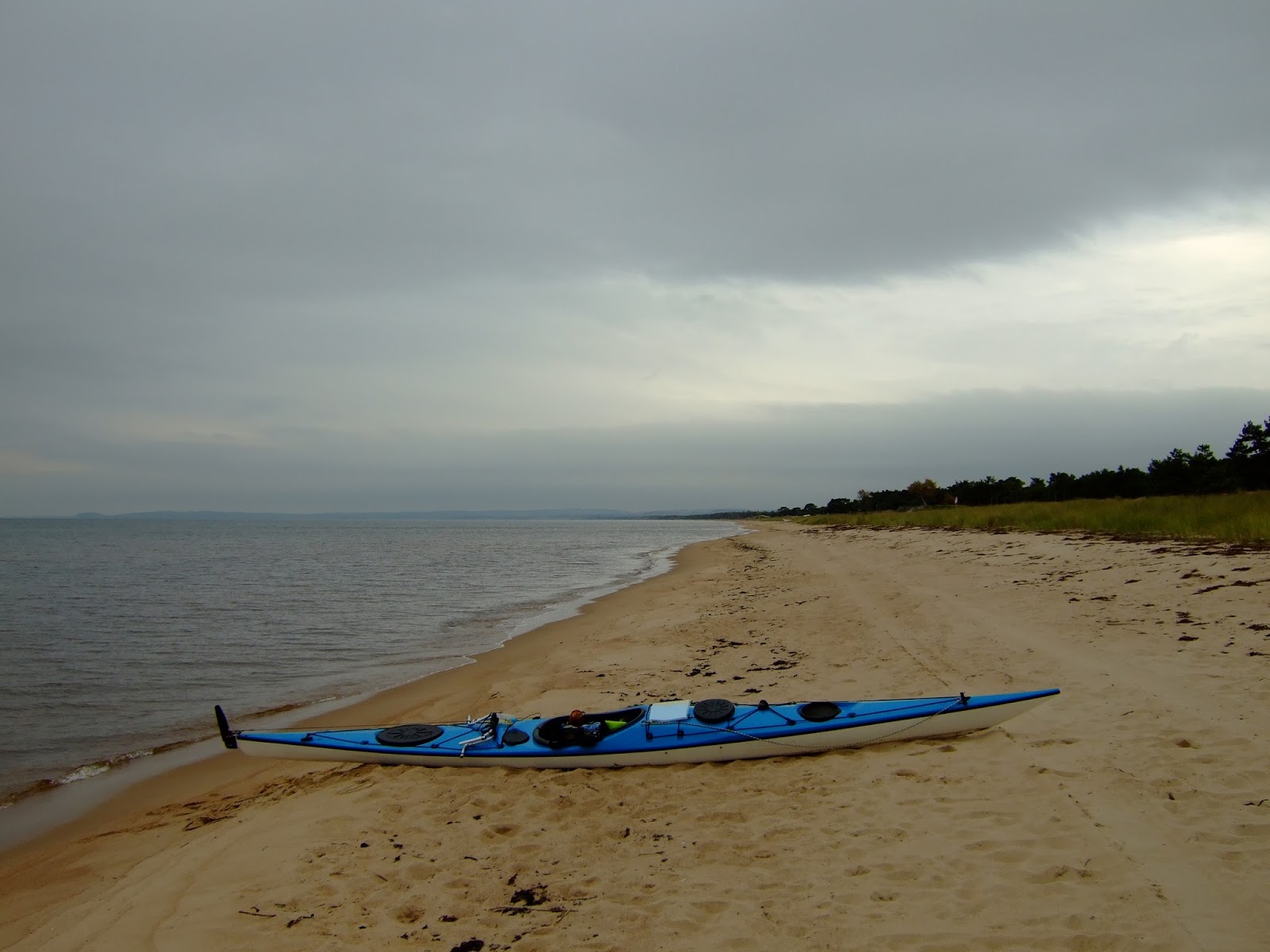
Die Freude war gross, als ich in der Hanö-Bucht an meinen ersten richtigen Strand an Land ging, und bei Trelleborg, südlich von Malmö war auf einmal wieder Sommer.
Nach all den wunderbaren Erfahrungen die ich in Aland und Schweden gemacht hatte war ich verwöhnt, und die Fahrt nach Dänemark und weiter nach Fehmarn eher unspektakulär .
In Fehmarn fand ich bald einen geeigneten Platz mein Kajak für den Winter unterzubringen, denn die frühe Dunkelheit und nasskaltes Wetter liessen mich nicht mehr weiterfahren.


It was the End of September when I went back to Stockholm to continue my trip. When I arrived at the  Kayak Club nothing reminded me after the time in the summer. I set up my tent in the club yard  and hoped that someone opened for me the next morning to let me have my kayak.  Only three days I stayed here, the nights became cold and weather was often overcast and misty. But I wanted to experience paddling in this time of the year and I certainly did not regret. 
It took me one month to go down the east coast of Sweden and further to Fehmarn in Germany.
First I had to find my way out of the archipelago of Stockholm and further going south, still paddling inside of hundreds of islands. They became less and less until I missed them completely and I remember the time being there and wondered if I ever come back here. 
The landscape I perceived as fascinating and breathtakingly beautiful especially when the setting sun and rising fog touched the island in a mystic light. It was the most intense and rememberable time in my entire trip so far. Also the silence and loneliness have touched me very much. But also the unpleasant side of autumn have infected me. On some days it rained and strong wind and high seas often made my life hard. Early sunset also was a problem on some days. Sometimes I more and more delayed going ashore in the hope to find a good place for camping and still had to land in darkness what made me find a place for my tent quite difficult. 
The joy was great when I kayaked onto my first real beach in Hanöbukten  and later near Trelleborg south of Malmö summer has come back surprisingly again.
After all the wonderful and beautiful experiences in Aland and Sweden I was quite spoilt and paddling to and through Danmark  and further to Fehmarn was more or less unspectacular.
In Fehmarn I soon found a place to store my boat over the winter because early darkness and wet and cold weather didn't let me go further.


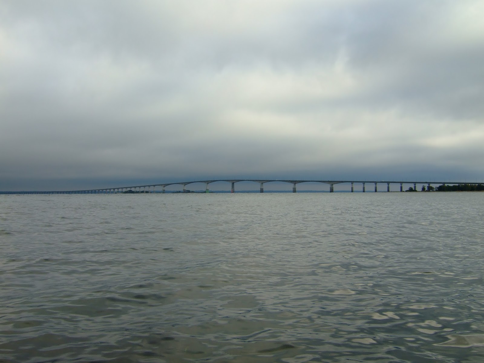
Die Brücke nach Öland
The bridge to Öland

Der erste richtige Strand
The first real beach


Die Brücke nach Mon
The bridge to Mon


Der Leuchtturm von Hyllekrog
The lighthouse of Hyllekrog


Tuesday, August 7, 2007

The archipelago of Stockholm / Die Schärenwelt vor Stockholm

Mein nächstes und vorerst letztes Ziel hiess Stockholm. Dort schien mir ein geeigneter Platz um mein Boot für ein paar Wochen irgendwo unterzubringen. So ging es immer entlang der schwedischen  Küste aber meist innerhalb der Inselwelt südwärts. Über die Schären hab ich ja schon berichtet, die unterscheiden sich hier nördlich der Hauptstadt nicht viel von denen zuvor. Was aber sofort auffiel und ganz anders war als zuvor, war der rege Schiffsverkehr der überall stattfand. Auch die Inseln schienen belebter. Eines Tages traf ich eine Gruppe Paddler aus Stockholm und luden mich ein mit ihnen zu zelten. Eine von ihnen war davon so angetan, dass sie mich, samt Boot, über den Fels an Land zog. Ich wusste erst gar nicht was ich sagen sollte, mich für die allzu gut meinende Geste bedanken oder doch verärgert sein. Die Schramme hab ich heute noch im Boot. Der Abend verlief aber dann doch sehr entspannt und nett. Leif, der Gruppenführer verpasste mir erst mal eine Massage, was nach so vielen Tagen äusserst gut tat. Danke Leif. Er gab mir noch den Tipp, beim Brunsvikens Kajak-Club vorbeizuschauen, da hätte ich eine Chance mein Boot zu lassen.
Am nächsten Morgen trennten sich unsere Wege aber wieder, ich musste sehen ,dass ich nach Stockholm kam. Und so kam ich ein paar Tage später auch bei besagtem Club an, und es war kein Problem mein Boot für einen Monat dort zu lassen. Mir gefiel es hier sehr gut. Ich durfte im Kraftraum schlafen und die Atmosphäre mit all den Racing-Leuten und unzähligen anderen Kajakern die mir Tipps gaben wie ich meinen Paddelstil verbessern konnte war einfach grossartig. Danke Love und auch Hannu für Eure Hilfe.
Nach ein paar Tagen im Club hiess es dann für mich zu gehen. Erst mit dem Bus nach Hamburg und dann weiter per Anhalter nach München.


My next destination for this time was Stockholm, the capital of Sweden. It seemed to be a good place for storing my boat for a month until I come back to continue my journey. I went southward most the time inside of the archipelago.  I have talked about the islands before. They are quite similar to those I  have seen before, still wonderful. But what was different was the traffic of boats and cruse ships much more then i have experienced before in the Aland's. Also the islands seemed much more visited. One day I met  a group of paddlers from Stockholm and was invited to camp with them for a night. One of them was so excited (well, what should say?) that she pulled me with the boat over the rocks ashore. I didn't know what to say in this moment. Thank her for her good intention or be angry. I still have that scratch in my boat. 
But the evening was nice and relaxed and Leif, the leader of the group gave me a massage what was so goood  after so many days in a kayak. He also gave me a hint to store my boat in Brunsvikens Kayak-Club of Stockholm. Next day we went our own ways again, and some days later I arrived at the place Leif was talking about. It was ok to leave my kayak here for a month and I liked it very much here with all the racing people and other kayakers who taught me improving the right techniques of paddling. Thank you Love and Hannu for your help.
After some days staying here in this wonderful atmosphere I had to leave. Going by bus to Hamburg and further to Munich hitchhiking


Leif und seine Gruppe
Leif and his group


Eine Insel vor Stockholm, voll mit Blaubeeren!
Last island before Stockholm, full of blueberries 

Brunsvikens Kanu-Club


Monday, July 30, 2007

Westward to Sweden / Westwärts nach Schweden

Der Wind hat sich ein wenig gelegt am nächsten Morgen, doch war er keinesfalls verschwunden. Aber mit neuem Elan und Können – jawohl! – gehts Richtung Norden nach Kökar. Denn ich musste mal ins Internet um herauszufinden, wann ich denn nun in München sein muss.  Auf der Suche nach einem Schlafplatz begegnete mir eine Gruppe Paddler aus Deutschland zu denen ich mich gesellen durfte und eine Nacht mit ihnen zeltete. Am Morgen danach trennten sich unsere Wege aber schon wieder, denn ich musste sehen, dass ich mal ein Stückchen westwärts komme, ich sollte früher als geplant in München sein. So wurde es ein langer Tag und fuhr an diesem Tag noch bis in die Nähe der Hauptstadt Aland's, Marienhamn wo mich jemand auf seinem Privatgrundstück zelten liess.
Am nächsten Morgen und ein paar Paddelschläge weiter, eignete sich der Oldtimerhafen von Marienhamn perfekt für den Ausgangspunkt einer Stadtbesichtigung sowie für Vorbereitungen, soweit sie denn von Nöten waren, für eine Überfahrt nach Schweden. Doch später tauchte der Platzwart des Hafens auf und vorbei war es mit gemütlichem zelten bei alten Schiffen und einer familiären Atmosphäre. Weiter ging es deshalb in die Nähe von Ekerö, wo ich ausnahmsweise mal auf einem Zeltplatz übernachtete.  Und da waren auch noch Marek und Chris aus Polen, die mir ganz stolz ihre geschätzten 5 Kilo Kartenmaterial des schwedischen Militärs zeigten auf denen gewiss jeder Stein verzeichnet war...
Aus der geplanten Überfahrt wurde dann doch erst mal nichts, denn nach dem ich  die letzten Inseln hinter mir gelassen hatte und schon ein gutes Stück weit draussen war, wurde es mir doch ein wenig mulmig zumute. Trotz neu erlernter Kenntnisse und Selbstvertrauen waren mir die Distanz von ca 30 Kilometern, starkem Gegenwind der Stärke 5 und Wellen bis 1,5 Metern hoch doch um einiges zu viel! So ging es zurück nach Signilskär, dem letzten Vorposten Finnlands vor Schweden sozusagen.
Kaum gelandet, kam mir auch schon jemand vom Militär entgegen die hier ihren einsamen Posten hatten und begrüsste mich mit einem freundlichem  "was zur Hölle, machen Sie hier draussen"!
Das wusste ich leider auch nicht.
Froh war ich dass er mich quasi in seinem Vorgarten seiner Station zelten liess, dem einzigen geschützten Platz auf der Insel.
Und da das Wetter nicht wirklich gemütlicher werden sollte , fuhr ich zurück in die Nähe von Storby um hier ein paar Tage zu bleiben, bevor ich es schliesslich doch schaffte nach Schweden zu kommen, bei wesentlich besseren Bedingungen.


The wind has only slightly calmed down the next morning, but with new enthusiasm and skills – yes, right – I paddled to Kökar to the north. Because I had to use the internet to find out when I finally had to be in Munich for work. While searching  for  a place to camp, I met some german paddlers I stayed with for one night and told them my story. But on the next morning  we again went our own ways, I still had to go westward quite a long way and wanted to make some distance, almost to Marienhamn that day, the capital of the Aland Archipelago. I had to be earlier in Munich than I planed before. After a long day somebody allowed me to camp on a private island, how nice.
The next morning, and the little harbor for historical wooden ships was the perfect starting point to go sightseeing and make preparations to cross over to Sweden. 
After I have done that, staying overnight in a cozy atmosphere right next to old ships became only a wish when the groundkeeper appeared and told me to leave.
I had to camp on a real campground near Ekerö that night, what I usually never do, and where I met Marek and Chris from Poland. They proudly showed me their pile of swedish military-maps weighting about 5 kilograms I guessed.
The planed tour over to Sweden I cancelled, because after I passed the last island of Aland quite in the distance, I was more and more scared of continuing, asking myself what i am actually doing here. Despite my new skills I learned and new confidence, the distance of 30 kilometers, strong winds force 5 against me and waves up to 1,5 meters  high was too much for me by far. That is why I went back to Signilskär, the last island before Sweden with a small military station.
Just landed in that moment, a military person came over from their lonely outpost and welcomed me with a friendly: "what the hell are you doing out here?"
I did not know this either!
Glad, that I was invited to camp in his backyard, the only protected place on the island.
And because the weather did not get better over the next days, I went back to the mainland near Storby, to stay here for a couple of days, before I finally made it to Sweden in much better conditions!


Auf manchen der Inseln hat sich jemand seinen Traum erfüllt
on some of the islands someone realized his dream


Signilsskär, Militärposten , kein Wetter um 30 Kilometer nach Schweden zu paddeln
Signilsskär, military station, not a weather to cross over to Sweden

Tuesday, July 24, 2007

The islands of Aland / Die Inseln Alands

Es ist ja nicht so, dass ma sich daran gewöhnen kann. Sein Leben könnte man hier in der weiten Inselwelt Aland's verbringen und doch nicht alle Inseln sehen. Ich dachte mir manchmal man bräuchte gar keine Karte um zu navigieren. Man fährt in irgendeine Richtung und man trifft ja doch auf eine Insel. Ich bedauere diese Menschen, die ihre Route hier hindurch akribisch planen und mehr Zeit verbringen dieser Route zu folgen als zu paddeln, überspitzt ausgedrückt. Und so bin ich einfach nur nach Kompass Zickzack in westliche Richtungen gefahren und nach drei Tagen zufällig auf Idö gelandet, südlich der Inselgruppe  Kökar .
Die Inseln in diesem Teil des Aland Archipels sind weniger bewaldet als die in der Nähe des Festlandes und manche sind, die Kleineren, sogar ziemlich kahl. Es ist die raue Schönheit und Abgeschiedenheit die ich hier, weit draussen, bewundere. Selbst jetzt in der Ferienzeit hat man die Inseln meist fast für sich alleine. Und besonders schön, ja, fast dramatisch wird es, wenn die Sonne untergeht. Dann hat man die Muse über die Welt nachzudenken oder zu meditieren, oder ganz still da zu sitzen und dann ist man auch mal  froh alleine zu sein.
Glück hatte ich auch in Idö zu landen, denn es schaut sehr nach heftigen Gewitter aus und Idö hat eine sehr schöne geschützte Bucht in der ich es mir , zusammen mit anderen Seglern, gemütlich gemacht habe. Nur Mücken und viele Zecken störten die Idylle.
Das Gewitter brachte starken Wind in den nächsten zwei Tagen, so dass ich gezwungen war hier zu bleiben. So hatte ich die Gelegenheit mich auch mal aus der geschützten Bucht heraus  zu trauen um Erfahrungen zu sammeln und zu sehen wie es ist bei hohen Wellengang draussen zu sein. Immer weiter traute ich mich aus der Bucht heraus,   so dass ich am zweiten Tag sogar Spass daran hatte mit den Wellen zu sein, die bei Windstärke 6-7 teilweise bis zu zwei Meter hoch wurden. Nur das surfen machte mir noch Angst und konnte ich noch nicht voll beherrschen, sodass ich es lieber sein liess. Es waren zwei sehr bemerkenswerte Tage hier.  Nicht nur, dass die Insel mit zugehöriger Bucht ein einziger Traum ist, ich ein schönes Camp hatte wo mich niemand störte, ausser die paar Kühe die ich erst am zweiten Tag bemerkte und mein ganzes Gemüse und Salat frassen, sondern auch weil ich zum ersten mal wirklich Erfahrungen sammeln konnte die es mir ermöglichten wesentlich entspannter und wetterunabhängiger zukünftige Überfahrten oder sonstige Unternehmungen im Boot anzugehen.


It is probably not possible to get used to it. You can spend your lifetime here and still would not see all of them, the islands of the Aland- Archipelago. And it came into my mind, that you don't  even need a map here. You just go in any direction and you will run into an other island anyway sometimes. I almost feel sorry for those people who plan their route in such a detail because they spend a lot of time being busy with their route instead of just paddling. And thats exactly  what I did: going westwards in kind of a Zickzack-course through these islands before I landet on Idö accidentally  after three days, south of the bigger group of Kökar.
Most of the islands here in the south are less forested then the ones closer to the mainland. Some of them are almost bald especially the smaller ones. It is the rough and harsh beauty and the loneliness out here what fascinated me. And when the day ends, the island start to glow in the last rays of sunlight, you think about the world and your life. Or meditate. Or just sit there in silence and it is good that you are alone. 
I was lucky to have landed on Idö because a heavy thunderstorm approached and the island has a very protected and nice inlet and made a perfect shelter for me and two other sailors who were looking for a safe place that night. Only  mosquitos  and ticks disturbed the cozy atmosphere here.
The thunderstorm brought strong winds the next two days, so I was forced to stay here for a while.
I took the chance to leave my camp and tried to experience and exercise other conditions outside of the protected area. Windforce 6-7 created waves up to two meters and I was too curious to go paddling then stay at "home" in my tent. I went outside, further and further away from the island and felt more and more comfortable and confident handling the waves and being outside and even had fun playing with them. Only surfing down the waves scared me quite a bit and tried not to get in such a situation. 
These were two remarkable days for me. Not only because I stayed on a beautiful island with a nice inlet where I camped undisturbed (until some cows appeared who ate all my vegetable and salad i brought with me), also because I made my first experience with situations I have not  handled before on my trip. It made me feel more comfortable and independent from weather, planing future crossings and trips with my kayak.


Versteckte Buchten überall
hidden places everywhere 

Man traut sich kaum aufs Wasser um die Ruhe nicht zu stören
Don't go paddling, don't disturb the peace

Kleine Bucht in Lee finden, anlanden, Boot verschnüren, Inselrundgang machen... nächste Insel – wird niemals langweilig!
find a place in lee, land, tighten the boat, go for a hike.... next island – never gets boring !

Inselwelt in Aland, fast-Paradies
Island world  in Aland, almost-paradise

Campen auf diesen Inseln spottet jeder Beschreibung
camping on these island: experience beyond any words


Thursday, July 19, 2007

The coast of Finland / Die Schären Finlands

Ich bin in Hangö angekommen. Von Porkala ging es immer westwärts, allerdings bei meist starkem Gegenwind. Gut, dass ich nicht einen Tag später für meine Überquerung angesetzt hatte.
Ich versuchte im Windschatten der Inseln zu bleiben und meine Route um die Inseln so zu planen, dass ich den wenigsten Wind abbekam. Allerdings ohne Karte, denn ich hatte keine. Ich hatte mir, noch in der Marina in Estland, Fotos von  Seekarten-Ausschnitten gemacht, die ich von finnischen Seglern dort geliehen bekommen habe. So hatte ich nur den Bildschirm meiner Kamera zum navigieren. Trotzdem fand ich den Weg durch die wunderbare Landschaft, allerdings ohne jemals eine Route auf einer Karte einzeichnen zu können. Vier Tage brauchte ich um hierher nach Hangö zu kommen, und sicherlich könnte man noch viel mehr Zeit dafür aufwenden. Es ist paradiesisch hier. je weiter westlich man kommt, desto weniger bewaldet sind die Inseln, umso typischer werden die Schären. In meinem Tagebuch vermerke ich: "traumhafte Schärenwelt um Tverminne herum" !
Da die Wettervorhersage zunehmend starken Wind aus West vorhersagte, suchte ich mir eine kleine Insel ohne Namen in der Nähe von Hangö um dort für ein paar Tage zu bleiben. Ich hatte sie für mich ganz alleine und schlug mein Zelt im Windschatten einiger Bäume auf. Tagsüber fuhr ich in die Stadt um Erledigungen und Einkäufe  zu machen, Gaskartuschen und Karten! zu kaufen, die ich bisher nicht gefunden hatte, ins Internet zu gehen, die Stadt zu besichtigen usw. Nachmittags ging es zurück zur Insel um es mir abends gemütlich zu machen. Das Zelt und meine Sachen blieben unberührt! So muss das sein.
Ein paar Tage später legte sich der Wind und entschloss mich weiter zu fahren. Auf nach Aland!


I arrived in Hangö. From Porkkala I went always westward , unfortunately against the wind which became quite strong and I was glad that I didn't leave Estonia one day later. I tried to hide behind the islands to avoid paddling against the wind and planed my route and navigated from the screen of my camera, because I did not have a map with me. Yacht people from Finland I met in Estonia lend me some nautical charts to make pictures of the area. That is why it is the only part of my entire trip with no route marked on a map. Still, I found my way through a wonderful landscape , especially around Tvärminne. 
Four days I needed to go to Hangö, but anyone could spend a much longer time in this wonderful world of hundreds of islands. These islands become less forested the further west you go and also become more typical for this kind of islands in Finland and Sweden. 
Because the weather forecast predicted strong wind for the next few days I was looking for a tiny island where I could stay a couple of days. The one I found I had for me alone and set up my tent behind some trees protection from the wind. During the day I went to the city to buy things like maps, food and cartridges which I did not find before. Spending some time in the city and the harbor was nice too. Later in the afternoon I went back to my own little island where my tent the rest of my things waited for me, not touched or moved by anybody . That is how it should be!
Two days later the wind calmed and it was time to continue my journey. Lets go to Aland!


Nähe Tvärminne
near Tvärminne

Nähe Tvärminne
near Tvärminne

Auf dem Weg nach Hangö
on my way to Hangö

Bei Hangö
near Hangö

Hangö

Meine kleine Insel ganz für mich allein
My little island for me alone

Saturday, July 14, 2007

Crossing over to Finland / Überfahrt nach Finnland

Ganz in der Früh führte der erste Weg zum Zoll, wollte dort ausklarieren, doch das ging erst mal nicht. Ich musste mit dem Boot vorfahren, anders geht das nicht. Das kann nicht wahr sein, dachte ich mir, die Anlieger sind bestimmt nicht geeignet für Kajaks. Was solls, dort ordnungsgemäss vorgefahren, ein leichtes Lächeln in den Gesichtern der Beamten, nochmals der Hinweis, dass ich nach einer Stunde weiter muss und sie wünschten mir viel Glück.
Die Wettervorhersage war einigermassen gut, Wind von West um 2-3 später 4. Es war diesig und ich guter Dinge. Das einzige was mir Sorgen machte war, dass aus einer 35 km Distanz eine 60 km Distanz wurde und, dass das Wetter doch noch ungemütlicher werden könnte, hab ich doch eigentlich keine Erfahrung mit so etwas.
Nach ein paar Stunden hatte ich besagte Nordspitze der Insel erreicht, nochmal auf die Uhr geschaut und in der Nähe des estnischen Aussichtsposten Pause gemacht. Bis hierher lief es gut, jetzt also nur noch die 35 km.
Aus dem Schatten der Insel heraus wurden die Wellen auch schon etwas höher, aber noch gut zu bewältigen für mich. Als dann jegliches Land hinter dem Horizont verschwand, ich auch etwas wehmütig auf die schöne Zeit in Estland mit ihren traumhaften Inseln zurückblickte wurde mir schon etwas mulmig zumute. Später frischte der Wind dann etwas auf was zur Folge hatte, dass die Wellen auch höher wurden, aber nicht schön langgezogene sondern ganz lästige kurze. Irgendwann tat auch immer mehr weh. Zuerst mein Hinterteil , dann die Handgelenke und schliesslich der Rücken. Der fortwährende Blick auf mein GPS Gerät tat auch nichts zur Linderung bei, denn die Restdistanz wollte nicht so recht weniger werden. Noch kein Land in Sicht, immer noch keines und auch 10 Kilometer vorher noch immer nicht. Ich zweifelte an meinem Navigationsgerät, doch was soll der falsch machen? Nicht bewusst war mir, dass das Land dort so flach ist, dass man fast schon stranden muss um zu wissen, dass man angekommen ist. So war es dann auch. Als ich die ersten Schären erblickte, war ich fünf Minuten später auch schon mitten drin. Was für eine Freude! Alle Schmerzen waren vergessen und ich hatte sogar noch die Kraft, mir ein besonders schönes Inselchen auszusuchen. Nach einer kurzen Rast dort wo ich bleiben wollte (ich kam kaum aus dem Boot heraus), musste ich, der Ordnung halber und um Probleme zu vermeiden , erst mal den Gang zum Zoll antreten, wieder einklarieren. Doch die haben mich schon erwartet. Die Esten waren so frei und haben mich angekündigt, und die Finnen konnten mich schon mit ihren super Späh-Ferngläsern seit der Mittagszeit am Horizont ausmachen. Na super! Willkommen in Finnland , ich war überglücklich!


I woke up early in the morning and after a small breakfast and packing things into my boat, the first thing I wanted to do was to check out from Estonia. But this was not possible. Customs wanted me to check out  from their own jetty even it was not build for a kayak to land. Anyway, it has to be done that way and with a little smile and making sure that I understood the  only-one-hour-break-agreement on Naissare they wished me good luck. 
The weather forecast was ok, wind from west, force 2-3 later 4 and I started quite excited. The only thing I worried about was that the crossing went from a 35 kilometers distance up to a 60 kilometers distance. I wondered if I was strong enough to make this through and was hoping that the wind wouldn't pick up. 
After a few hours, I arrived at the northern point of the island and made my break there as I agreed with the officials.  Only 35 kilometers left and I continued with a good mood and was thinking back to the good time I had in Estonia. Waves became a little bigger further outside, and when all land disappeared behind the horizon I realized what it means to be out in the ocean, alone, even it was only the gulf of finnland.
Later about halfway to the other side of the gulf, the wind picked up a little bit and for that the waves became bigger. They were nasty short waves not the nice and long ones you wish to have. And also my body begun to hurt. First my butt, the shoulders and neck, then the wrist and back.
I was continuously looking at my GPS device but it didn't help to ease my pain, because the remaining distance didn't seem to shorten much over the time.
No land in sight. Still no land anywhere and I was wondering if my GPS was working correctly. But why should it not work properly? I was not quite aware, that the land is very flat and you first realize that you are there when you almost arrived. And that is what happened.   I was in the middle of the islands five minutes later after I saw the first rocks. How joyful and glad I was at this moment. I forgot all about my pain and still had enough strength  to look for a real nice island just for me alone.
After a little break there, I had to check in with customs first to avoid problems later.
Funny that they already expected me. The Estonians told them that I come and with their super-spy-binoculars they have spotted me since long time ago, when I still was in the middle of the gulf. How great! Welcome to Finland, I made it and was happy for that!


Erste Landung in Finland
First landing on Finland


Thursday, July 12, 2007

New plan for a longer journey / Neuer Plan für eine längere Reise

Während ich die letzten Tage paddelte,  kam es mir nicht mehr aus dem Sinn, dass es unlogisch sei, das Kajak nach der Tour per Spedition oder sonst irgendwie nach Deutschland zurückzuführen. Und ich kam mehr und mehr zu dem Entschluss , auch wenn es ungewöhnlich geklungen hat, es nach Hause bzw. nach Deutschland  zu paddeln und wenn es nur in mehreren Etappen zu schaffen sei. Und da ich die Küste über Polen nicht so spannend fand wie die Route über die bekannten Traumreviere Aland und schwedische Schären, stand fest, das mache ich! Blieb nur das Problem mit der Querung des finnischen Meerbusens. Aus diesem Grund entschloss ich mich hier aufzuhören, ich blieb nochmals eine Nacht auf Pedassaar, und testete ob ich die 35 Kilometer, die kürzeste Distanz zwischen Estland (Naissare Nordspitze) und Finnland bei Porkkala, schaffe. So ging es direkt von Pedassaar zurück nach Aegna, ziemlich genau 35 Kilometer. Das müsste ja dann wohl zu schaffen sein, dachte ich mir, auch wenn es an entsprechender Ausrüstung für solche Touren fehlte. Eines wollte ich aber unbedingt noch machen und zwar nochmals auf die Insel Naissare zu gehen. Ich wollte diese Insel komplett erkunden auch wenn man dafür eigentlich eine Genehmigung bräuchte. So fuhr ich, nach einer Nacht auf Aegna, rüber und an die Westküste, zog mein Kajak hoch und musste erst mal einen Platz für eine  Nächtigung hier finden und das Kajak im Wald "verstauen" .
Was ich hier auf dieser Insel fand übertraf meine Erwartungen voll und ganz. Märchenwälder, unberührte Küsten, verfallene Bunkeranlagen, Kanonen- und Verteidigungsanlagen, Munitionsdepots, rostende Torpedos die einfach so am Wegesrand rumliegen und Einsamkeit per Excellence. Nur an der Südspitze wohnen ein paar Leute die versuchen zu erhalten was noch zu erhalten ist.
Zurück im Hafen und auf meinen gewohnten Platz, sprach ich mit den Leuten von der Küstenwache und dem Zoll mit der Bitte, nach dem ausklarieren doch noch eine Nacht an der Nordspitze von Naissare verbringen zu dürfen, allerdings leider mit einer Absage. Nur eine Stunde dürfe ich mich dort nochmal ausruhen dann muss ich die Insel verlassen. So blieb  ich noch zwei Tage hier in der Marina um ruhigeres Wetter abzuwarten, denn ich musste diese Überfahrt machen. Ansonsten hielt mich nicht mehr viel hier, denn alle die ich kannte waren nicht mehr da.


While I was paddling the last couple of days, it came into my mind that it was not the best idea to just transport the boat home to Germany however this should have been done.  Instead I liked the new plan to do it the natural way – paddling home. I still had plenty of time, had to be in Munich in mid August for work. The fastest and shortest way would have been the baltic coast and the coast of Poland but then I would miss some of the dream-destinations for paddlers: The Aland Islands of Finnland and the Coast around Stockholm with its thousands of tiny islands off the coast. 
So I decided to make this plan real but there was the only problem of crossing the gulf of Finland, not so easy for a beginner. The shortest distance from Estonia to Finland is about 35 kilometers .
To practise paddling the same distance I decided to stop here, stayed one more night on Pedassaar, and went back to Aegna in one piece without going ashore in-between, around 35 kilometers. This can be done, I said to myself, and was quite confident to do this trip even I did not have all the "usual" equipment for doing such a crossing .  One more thing I wanted to do before going to Finland, was to hike and experience Naissare again. I landed on the west side of the island one day after I arrived on Aegna.  Had to "store" my kayak first underneath bushes and trees before exploring the island. What I saw here exceeded what I expected by far. Enchanted forests , untouched nature and coast, bunkers, munition depots and defense constructions from world war two and loneliness you can not imagine. 
Back on my place in the marina I prepared for the crossing. I asked the customs and border patrol if I could stay one night at the northern tip of Naissare after clearing out of the country, but they did not permit. I only was allowed to rest for one hour before I had to leave the island.
I stayed two more days for the weather to calm , because nothing hold me here, since everybody I knew was gone .


Die Bilder sind alle auf Naissare gemacht worden
The pictures are all from Naissare


Friday, July 6, 2007

The islands of Estonia / Die Inseln Estlands

Die Vorfreude war gross, hab alle meine Sachen gepackt, nicht so wie bisher, als ich wusste ich komme in den Hafen zurück und finde mein Zelt wie gewohnt wieder vor. Noch ein Servus zu den Leuten hier im Hafen die mich kennengelernt haben, und los ging es.
Im Nachhinein erfuhr ich, dass fast alle Inseln hier im estnischen Norden Naturschutzgebiet sind und man deswegen eine Genehmigung braucht sie zu besuchen.
Zuerst ging es wieder nach Aegna, die ich ja schon kannte. Und weil es erst spät los ging war es auch meine erste Übernachtung dort.
Auf Kräsuli begegnete ich niemandem ausser einer alten Frau die mich freundlich begrüsste aber auch deutlich machte, dass dies eine  Privatinsel sei. Deswegen gleich weiter nach Prangli was für mich die erste längere Fahrt etwas abseits der Küste darstellte und weil es noch früh am Tag war musste ich erst mal noch Keri machen, das etwa 6 Kilometer weiter draussen im finnischen Meerbusen liegt. Es  war eine Fahrt, ja sagen wir,  über offenes Meer, weil zudem auch die Wellen höher wurden und für mich Neuland darstellte.
Keri muss hier extra erwähnt werden, weil es eine, meiner Meinung nach, besondere Insel ist. Es gibt da einen Leuchtturm und andere Gebäude die alle noch gut erhalten aber verlassen sind. Anzulanden war schwierig, schliesslich fand ich etwas angespülten Kelp an der steinigen Küste wo ich einigermassen sanft anlanden konnte. Später erfuhr ich, dass der letzte Leuchtturmwärter erst vor wenigen Jahren die Insel verlassen hat und alles so verliess wie es heute noch dort aussieht. Alles schien so geblieben zu sein wie er es verlassen hat. Die Sauna, Küche und Wohnraum, als hätte gestern noch jemand darin gewohnt. Für mich waren es besondere Momente, fast schon ein Privileg hier zu sein, alleine, nur die hunderte Seevögel jeder Art die so gar keine Scheu hatten. Hier blieb ich die Nacht, nach langer Zeit wieder eine Matratze.
Die nächsten Tage ging es zurück nach Prangli, weiter nach Aksi, Rammu, Koipsi, Rohusi und Pedassaar. Ausser Prangli sind alle Inseln unbewohnt. Nur Schafe, unberührte Natur und Spuren längst vergangener Besiedlung waren zu finden. Niemand schien sich für diese Inseln zu interessieren,  ich war immer alleine, noch nie habe ich so viel beglückende Einsamkeit erfahren wie hier.


I was excited when I left the marina. I said good bye to those who knew me here and the boat was loaded with all I had and food for two weeks. I never had done this before, not coming back to the harbor with my tent waiting for me at the usual place. 
Again I visited Aegna and stayed here the first night because I started late this morning. The next day i was on Kräsuli where a old women told me to leave because the island supposed to be private. Some old tanks here, left overs from world war two. I headed further to the east, towards Prangli the first longer distance, but since it was still early in the afternoon I decided to continue to Keri. A lonely small island to the north and for me the first real offshore experience also because waves became bigger here.
Keri needs extra mentioning here, because it was special to me. Landing was difficult, stones everywhere but I found a tiny spot where kelp was washed ashore and made a landing more soft.
There is a beautiful lighthouse here and some other buildings, all in very good shape but abandoned .
I was welcomed by hundreds of seabirds many kinds, not shy at all and it seemed that they had not seen any humans for a long time. Later I found out that the last lighthouse keeper left the island just some years ago, and he left everything how it looks like today.  For me this was a special moment, to be here alone like a privilege.  I stayed here one night, on a real mattress, and left the island next morning without any trace of me as if I was not here. 
The next couple of days I went back to Prangli, to experience the simple life of the few people who life here, further to Aksi, Rammu, Koipsi, Rohusi and Pedassaar. Except Prangli all are uninhabited. Only sheep, untouched nature and signs of humans who lived here long time ago I found. Nobody seemed to be interested in these islands, I was always alone. And as I said before, i never found so much silentness and tranquility before in my life. Beautiful here.


Typische Küste der estnischen Inseln
typical coast of the islands in the north

alter Panzer auf Kräsuli
old tank on Kräsuli

Keri aus der Distanz
approaching Keri

Keri

Keri vom Turm aus
Keri from the tower

Keri

Keri

Keri

Steinkreise auf Aksi
circles on Aksi

Insel Akis
island of Aksi

Aksi